|
Analogue modeling is a simplification of Nature; using this method, structures formed due to the deformation of rocks can be modeled and investigated. The history of physical (tectonophysical) modeling goes back at least 130 years. Cadell was one of the first known to make a model of faults and folds using simply sand and clay - figure to the right.
Physical modeling deals with simulation of real geotectonic processes by using analogue materials instead of rocks, and substituting natural tectonic stresses, temperatures and pressures by specifically selected laboratory conditions. While deforming selected models with initial fault structures again and again, the modeller registers all newly formed strain structures (usually with digital camera) and, then, analyzes dozens of images to select and outdraws repeating zones of high strain. Many years of research experience show that no matter what direction of stresses and what materials are chosen, only a few such zones of greatest deformation with an amazingly stable spatial arrangement are always found! These zones in experiments and their analogues in nature, called structural (tectonic) concentrators. Structural concentrators play a key in localizing epicenters (hypocenters) of the mordern and past earthquakes, as it is discussed here: www.remoteexploration.com/analogue-modeling-in-seismotectonics.html They also outline the most favorable localities for any type of structurally controlled mineral, hydrocarbon and water deposits. |
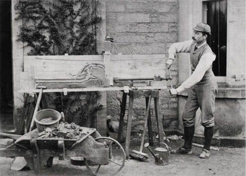
Early analogue modelling done by Cadell (1889). https://virtualexplorer.com.au/article/2002/48/thermomechanical-analogue-modelling/paper1.html
|
Basically, tectonic deformation, as any deformation, consists of three consecutive stages: elastic (reversible), plastic and rapture (permanent, irreversible). When the plastic stage is short in time and insignificant in magnitude we usually describe the deformation as brittle - it occurs under relatively low temperature and/or high stresses and high strain rate.
During all these stages in the heterogeneous geological media (faults are the most important of heterogeneities) mineralization tends to localize in the (or close to) zones of low compressive and/or high tensile stresses. Generally speaking, we may say that mineralized fluids move from zone of high compressive stresses into zones of openings (raptures, fractures, faults) and low compressive (or high tensile stresses) where they precipitate and form ore bodies.
Thus, if we use physical modeling to allocate the most favorable zones for deposit discovery we have to find zones of: high rapture deformation or, in other words, zones with high density of fractures and openings - so called 'dilation (dilatation) zones', or in the areas of relatively low compressive stress compared to adjacent high-stressed zones.
To cover all three stages of deformation in experiments we have to use two different types of materials (these are just technical aspects of the modeling and won't be discussed here) and, therefore, two different series of experiments have to be conducted: elastic deformation (reversible) and plastic + rupture deformation (irreversible).
|
|
|
|
|
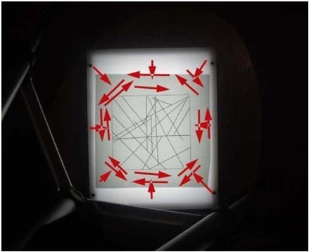
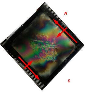
Elastic modeling (Photoelasticity). The method is mostly used in cases where mathematical methods become quite cumbersome, and it is based on the property of birefringence, which is exhibited by certain transparent materials.
In the gelatin block with dimensions 20x20x2.5 cm a series of cuts is made (main faults/lineaments). These cuts represent main lineaments (faults) obtained from lineament analysis of the satellite images. The same fault-template is used in all experiments, yet its orientation relative to stress varied in each case. The sample is placed between two polarizing films, deformed, and the interference pattern is recorded and analyzed. |
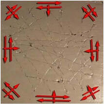
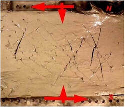
Plastic Modeling. The model itself is made with clay dope whose mechanical properties satisfy, in general, the demands of The Theory of Similarity for this class of analogue modeling.
In the clay block with dimensions 20x20x2.5 cm a series of cuts is made (main faults/lineaments). These cuts represent main lineaments (faults) obtained from lineament analysis of the satellite images. The same fault-template is used in all experiments, yet its orientation relative to stress varied in each case. |
|
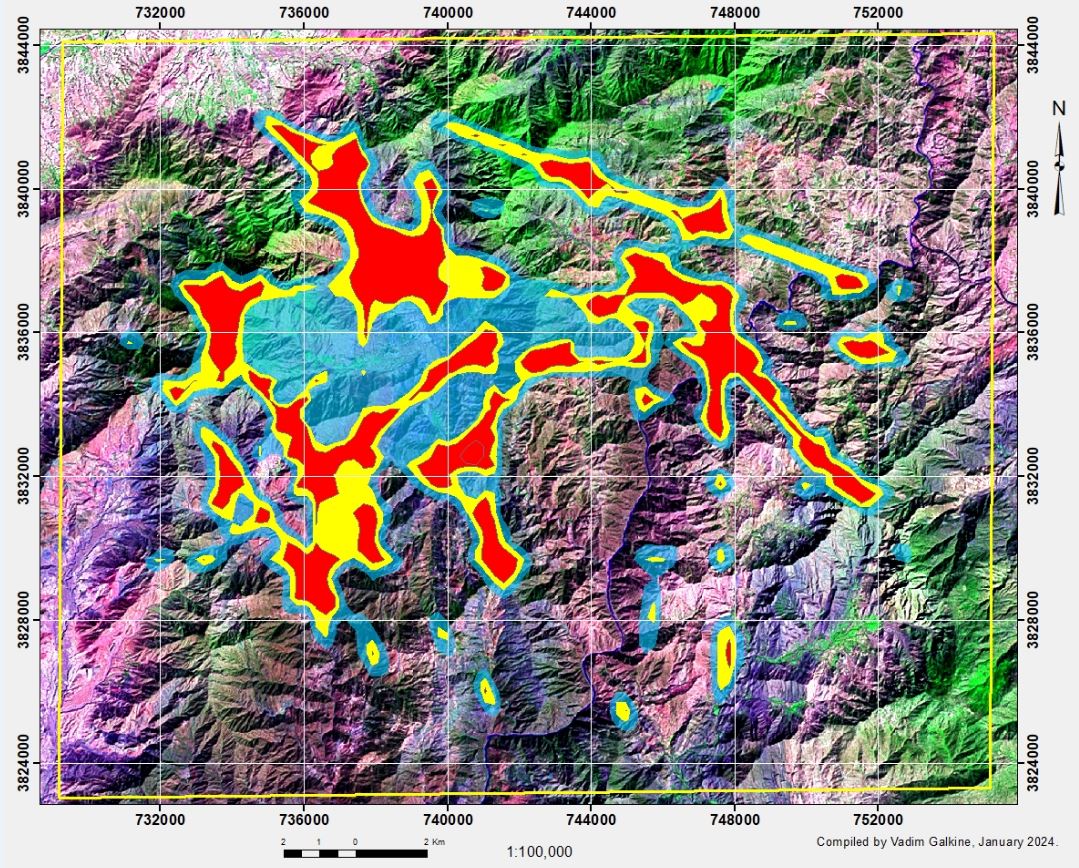
The photographs of the experiments (12 in elastic and 12 in plastic/rapture field separately) are analyzed. Dilation zones are outlined in each experiment (figure below, left). The stacking of the outlines of such zones onto each other gives us the opportunity to identify the areas with the highest proportion of the openings and fracturing (dilation) - figure below, right. We call these zones Attractors of Deformation (Tectonic Concentrators). They also represent the most permeable zones in the area under study. As a result, the Modeling–Based Exploration Target Maps (separately for elastic and plastic/rapture fields) are built.
This Exploration Target Map may be taken as independent final result if AM was requested by the Client as stand-alone separate method application. This map can also be taken as a Preliminary Exploration Target Map in case it is planned to combine the Map with the results of the MHSLA. |
|